Maps & GIS
House locations, depth contours, parcel data, and an interactive GIS viewer for Lake Julia.
House locations, depth contours, parcel data, and an interactive GIS viewer for Lake Julia.
House Map
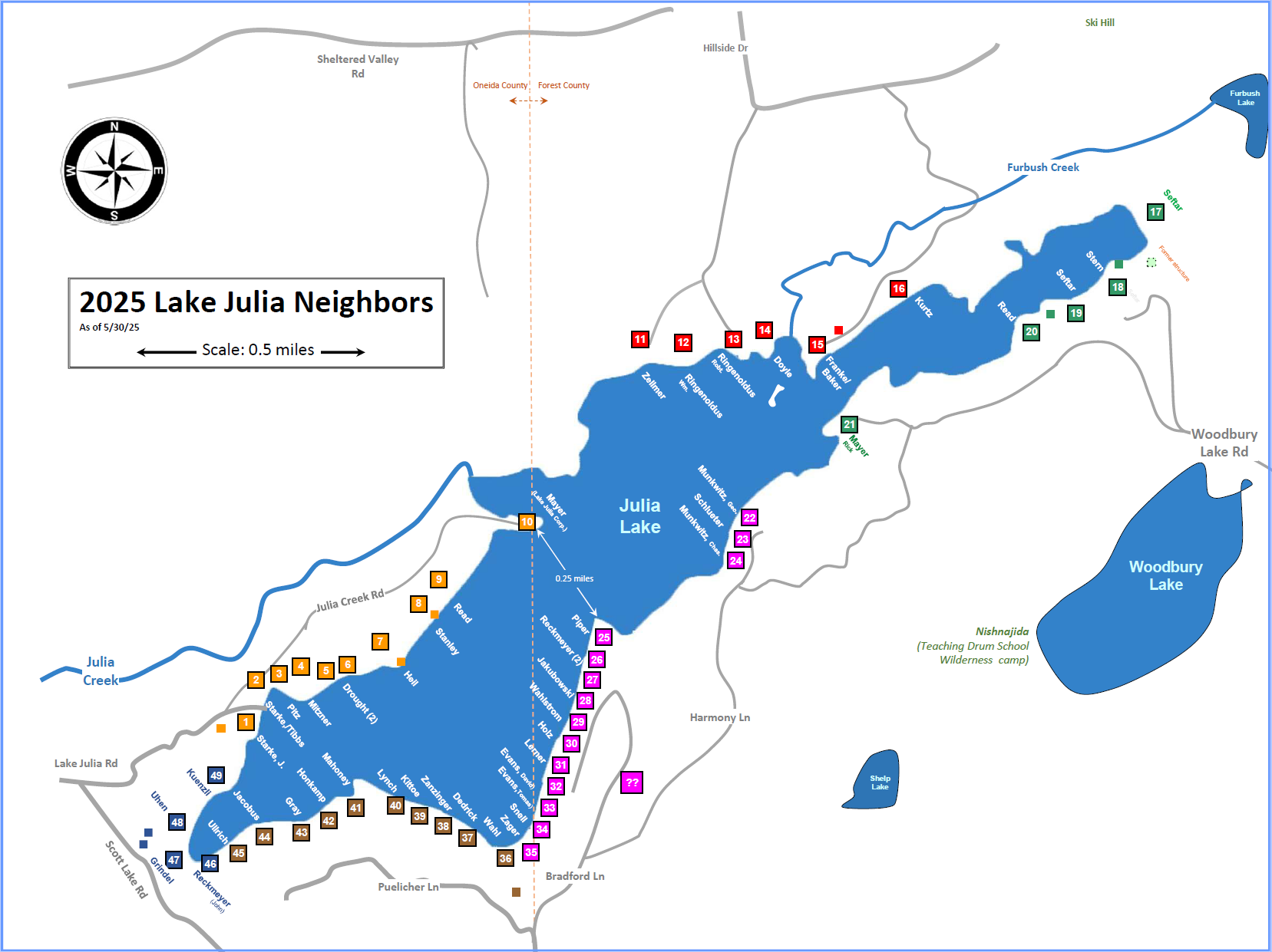
49 identified properties numbered #1–49 beginning at the public boat landing, color-coded by access road. Updated episodically since 2002 and sized at 18" × 24" — prints clearly at full size. House numbers are used throughout this site to identify properties and families.
Depth Map
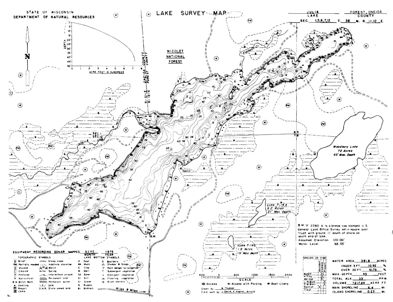
Wisconsin DNR depth survey of the lake bed (1975), plus a simplified version highlighting the more treacherous rock beds and shallow areas. Observations through 2020 show no significant changes from the original survey.
Download State Bathymetric Map (.pdf) →
Download Simplified Hazard Map (.pdf) →
GIS
Our GIS application is an interactive web-based map that brings together publicly available data — parcel boundaries, lake depth contours, hydrology, elevation, and ground slope — along with Lake Julia-specific information curated by our board and community members. This application is tailored to our lake, giving residents a single place to explore cabin and property details, investigate the lake's underwater bathymetry, examine surrounding topography, switch to satellite imagery, and pull up ground measurements. As our community continues to contribute data and new public sources become available, the map will only get richer over time.
The WI DNR tool used to identify water resources, wetlands, floodplains, and dams. It allows users to view, analyze, and download data on water quality, fisheries, and construction permits.
County Parcel Maps
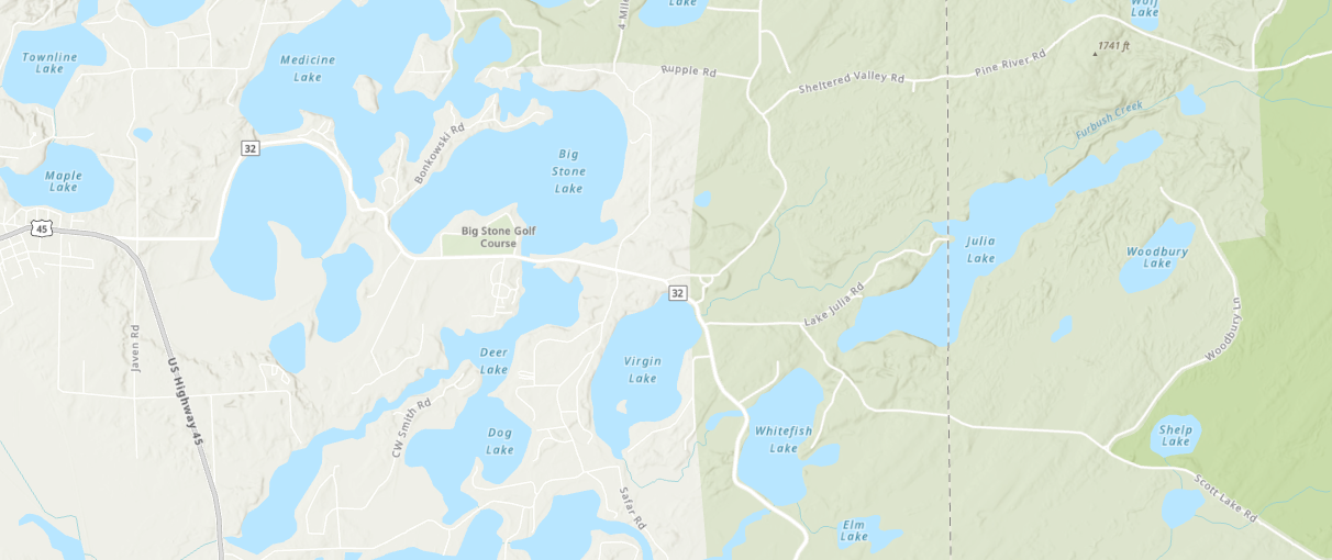
The county taxing authorities publish detailed maps showing tax parcels, owner information, and assessment and payment status. Lake Julia spans both Oneida County (west half) and Forest County (east half).